
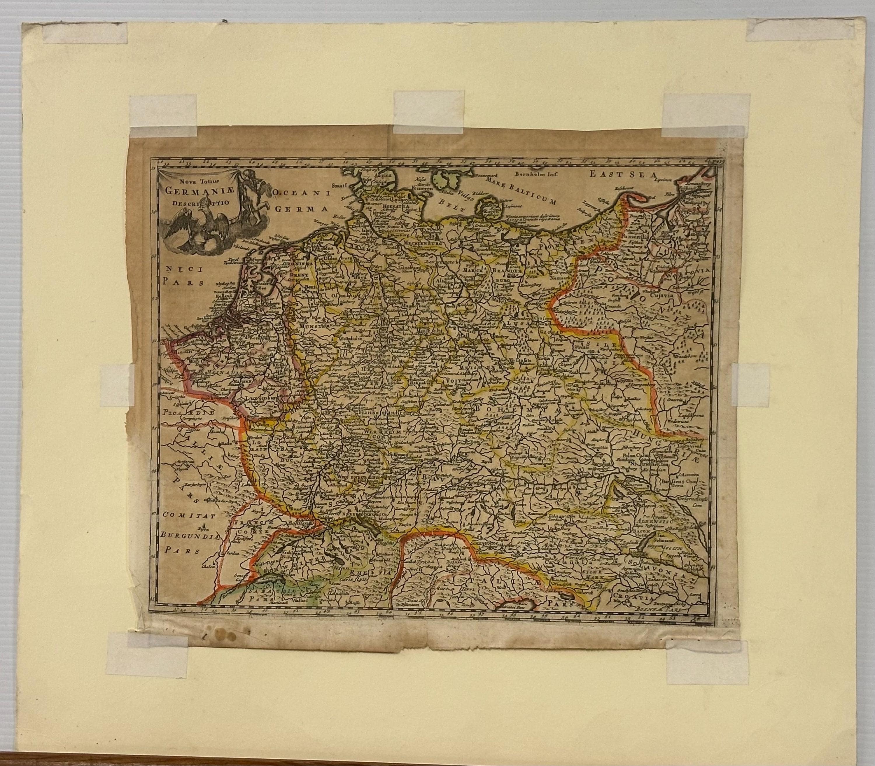
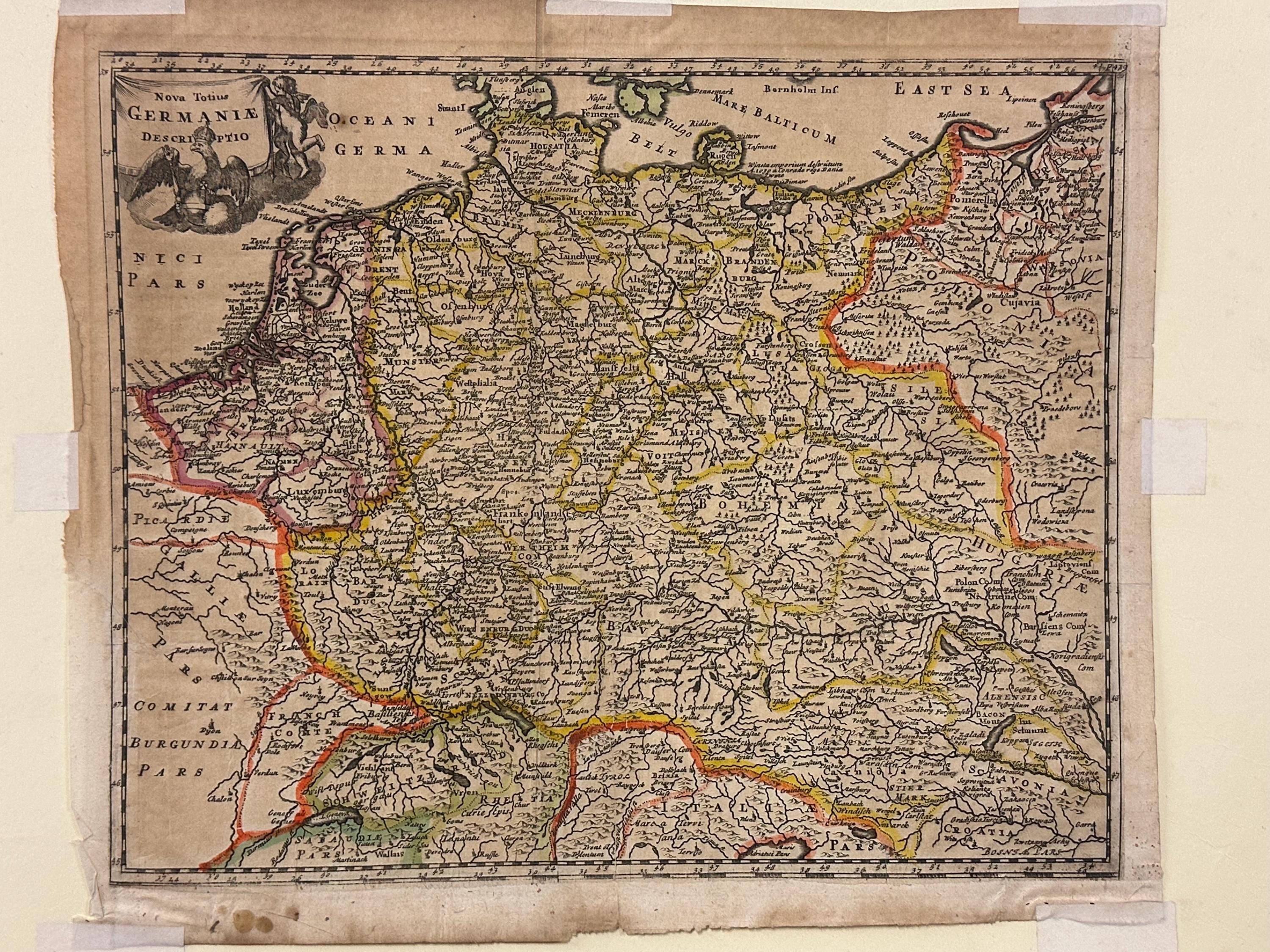
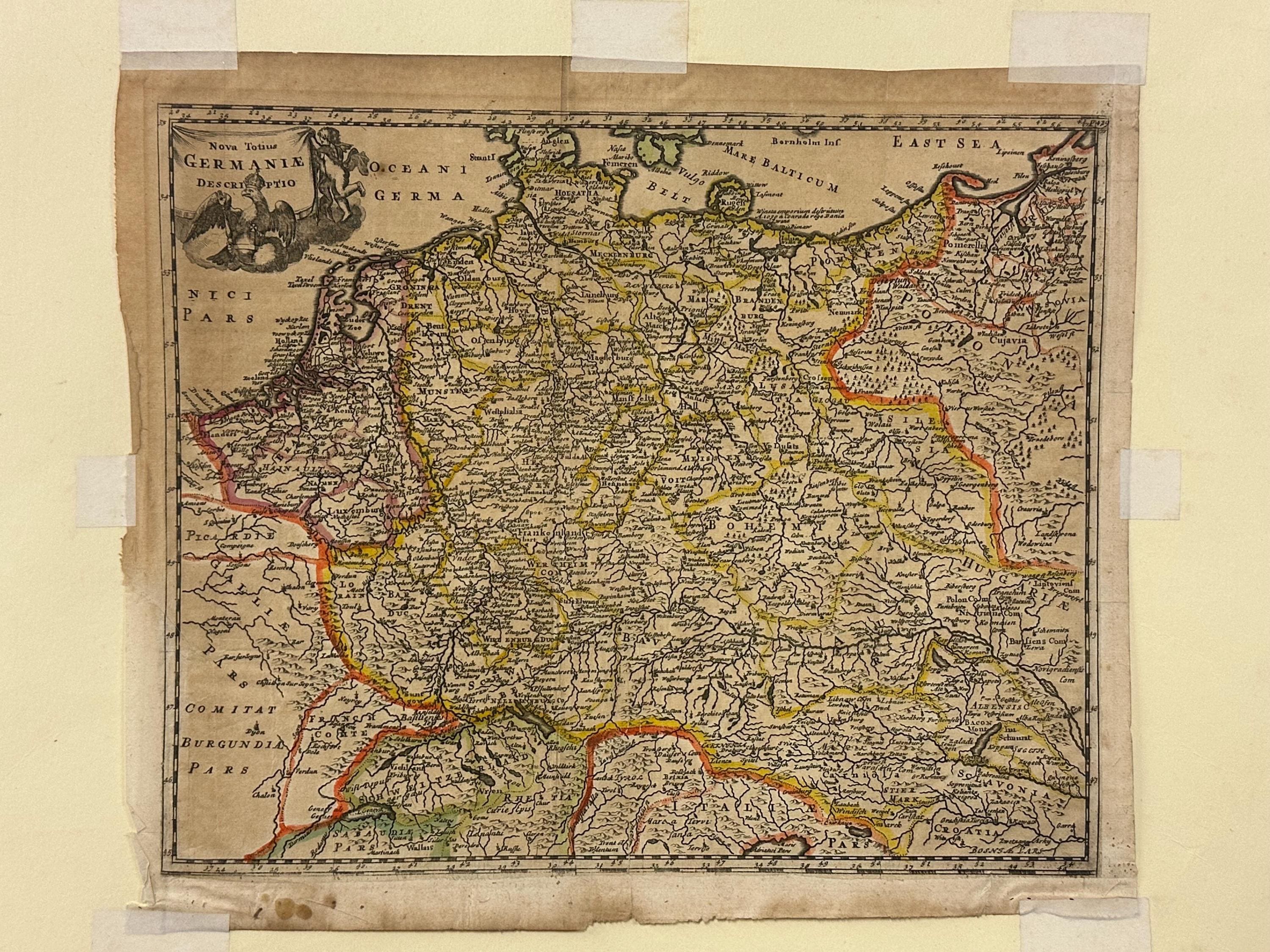
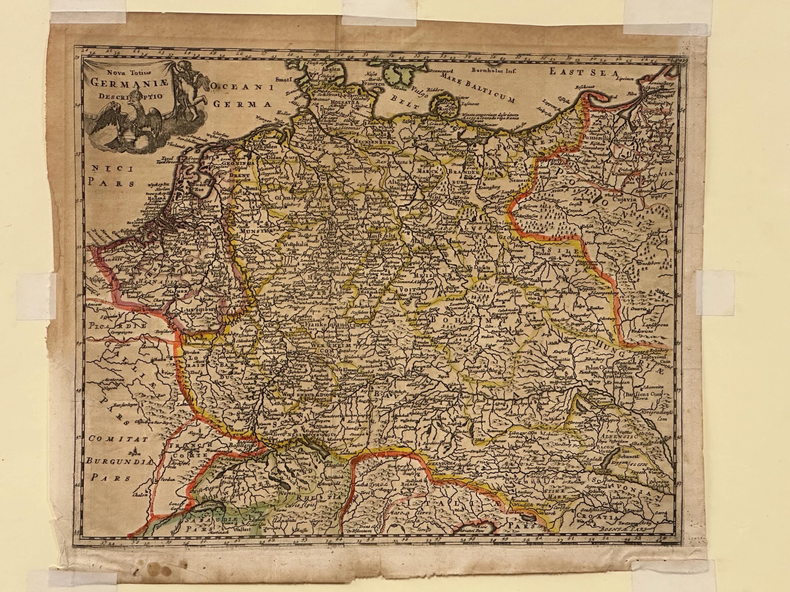
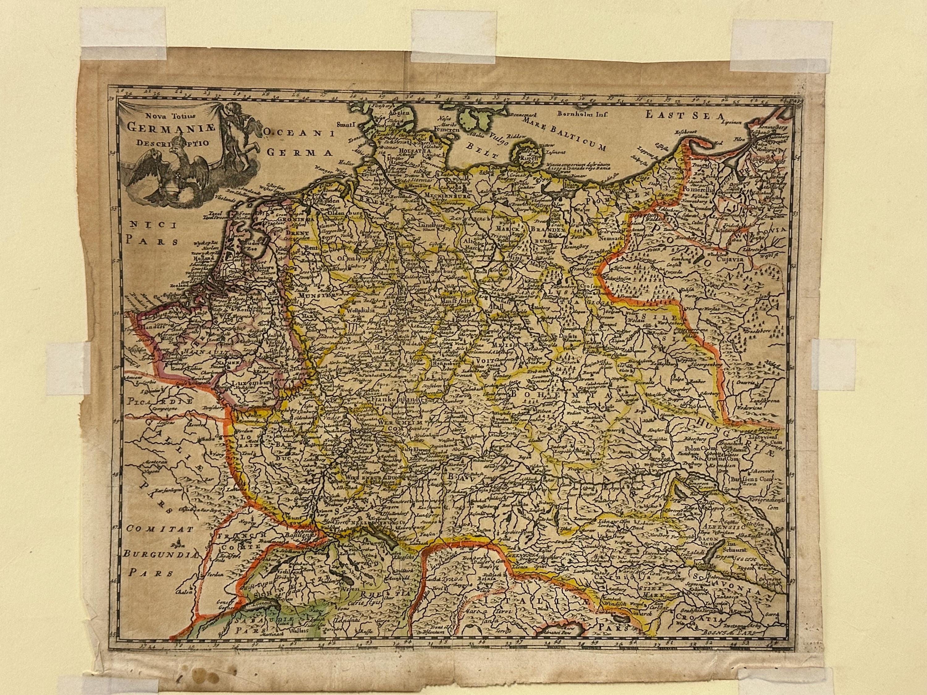
Antique Hand Coloured Engraved Map – “Nova Totius Germaniae” – Map of Germany

$188.33
Antique Hand Coloured Engraved Map – “Nova Totius Germaniae” – Map of Germany
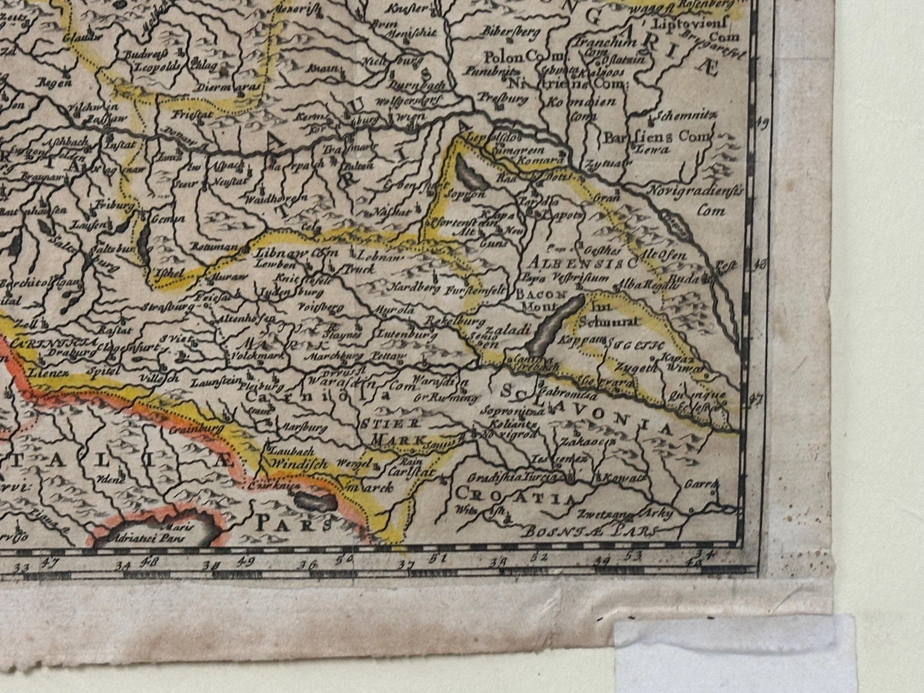
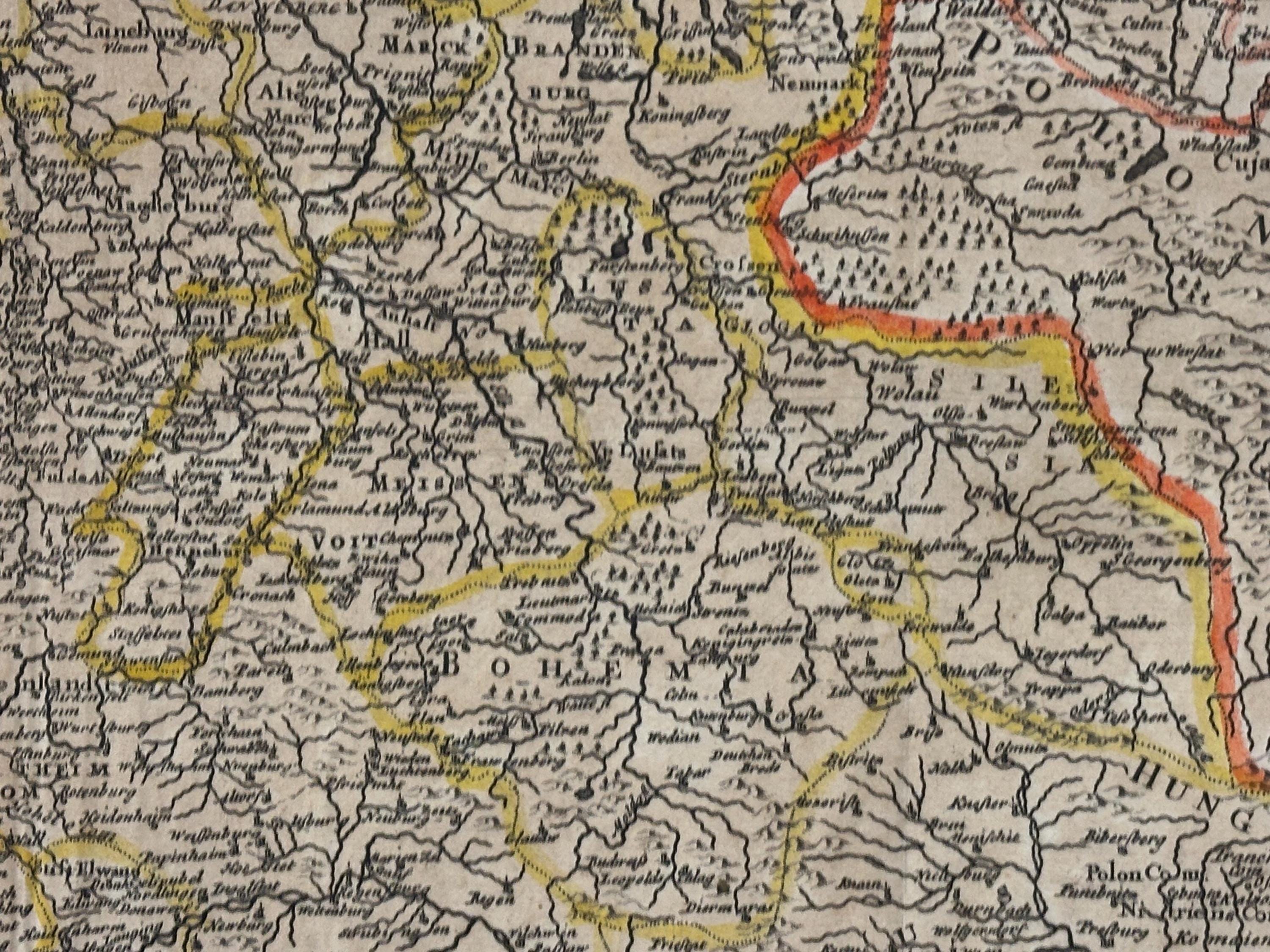
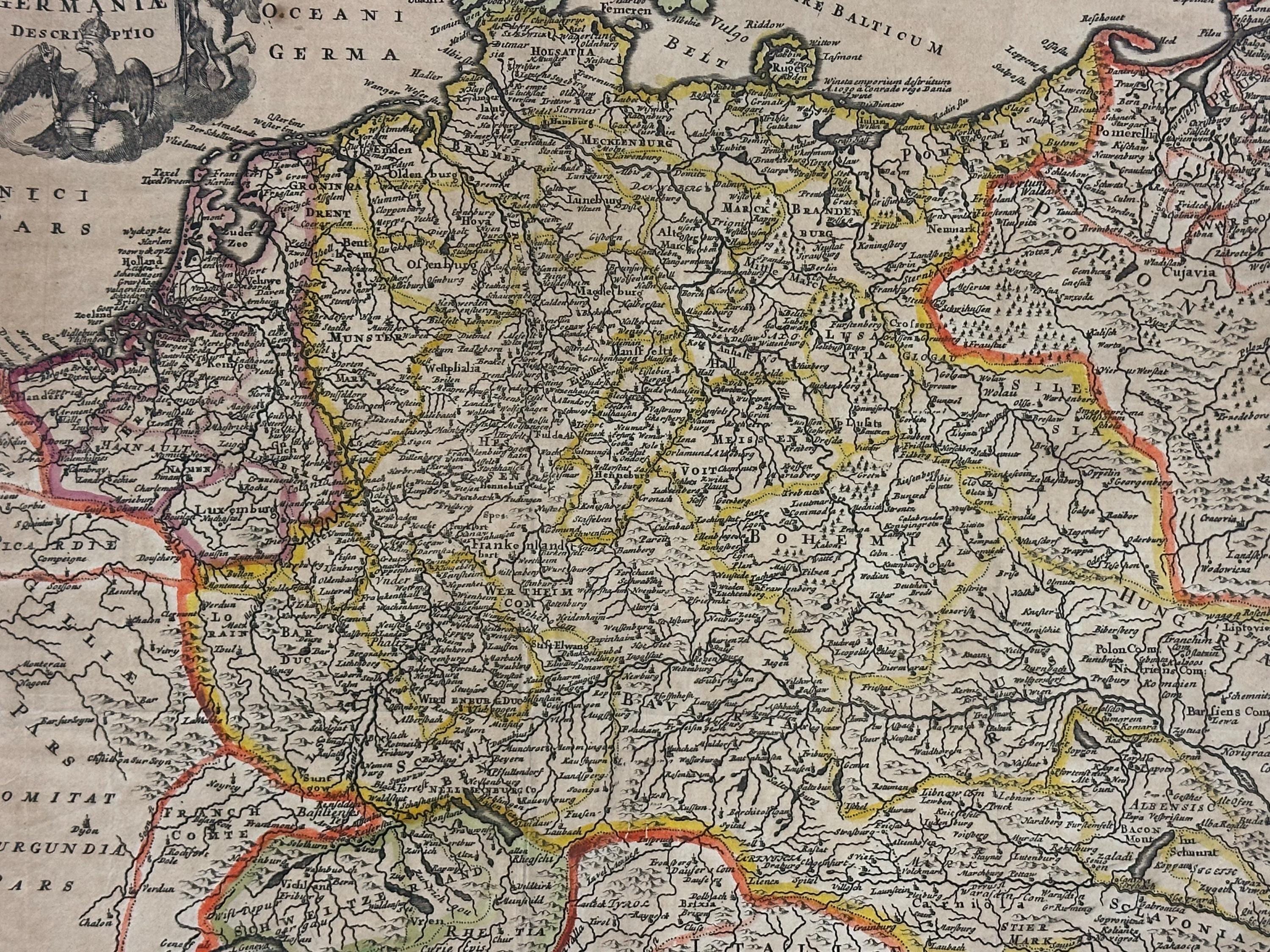
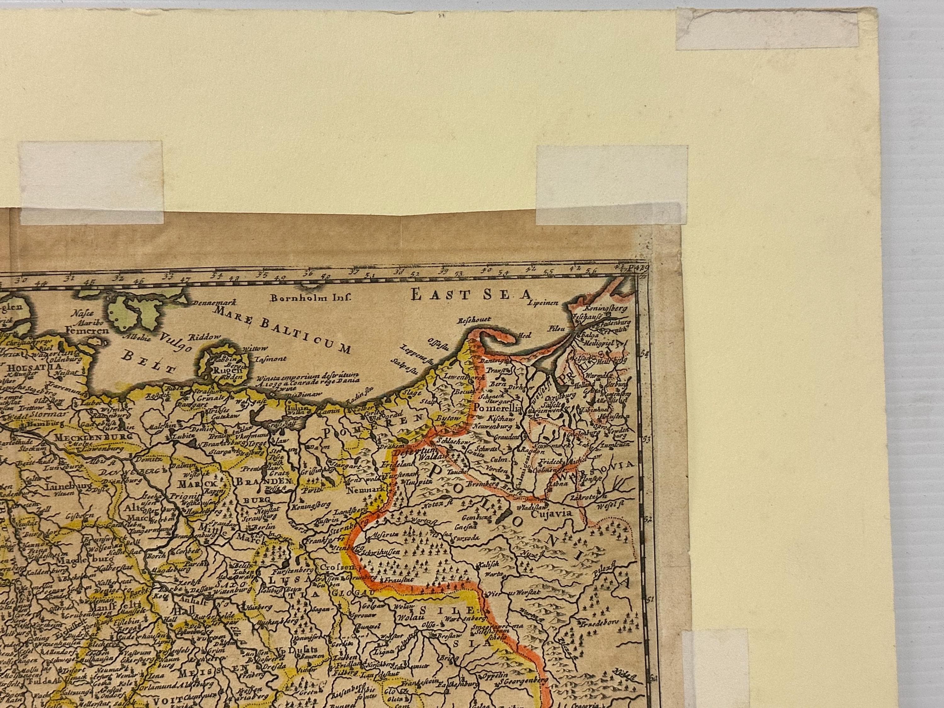
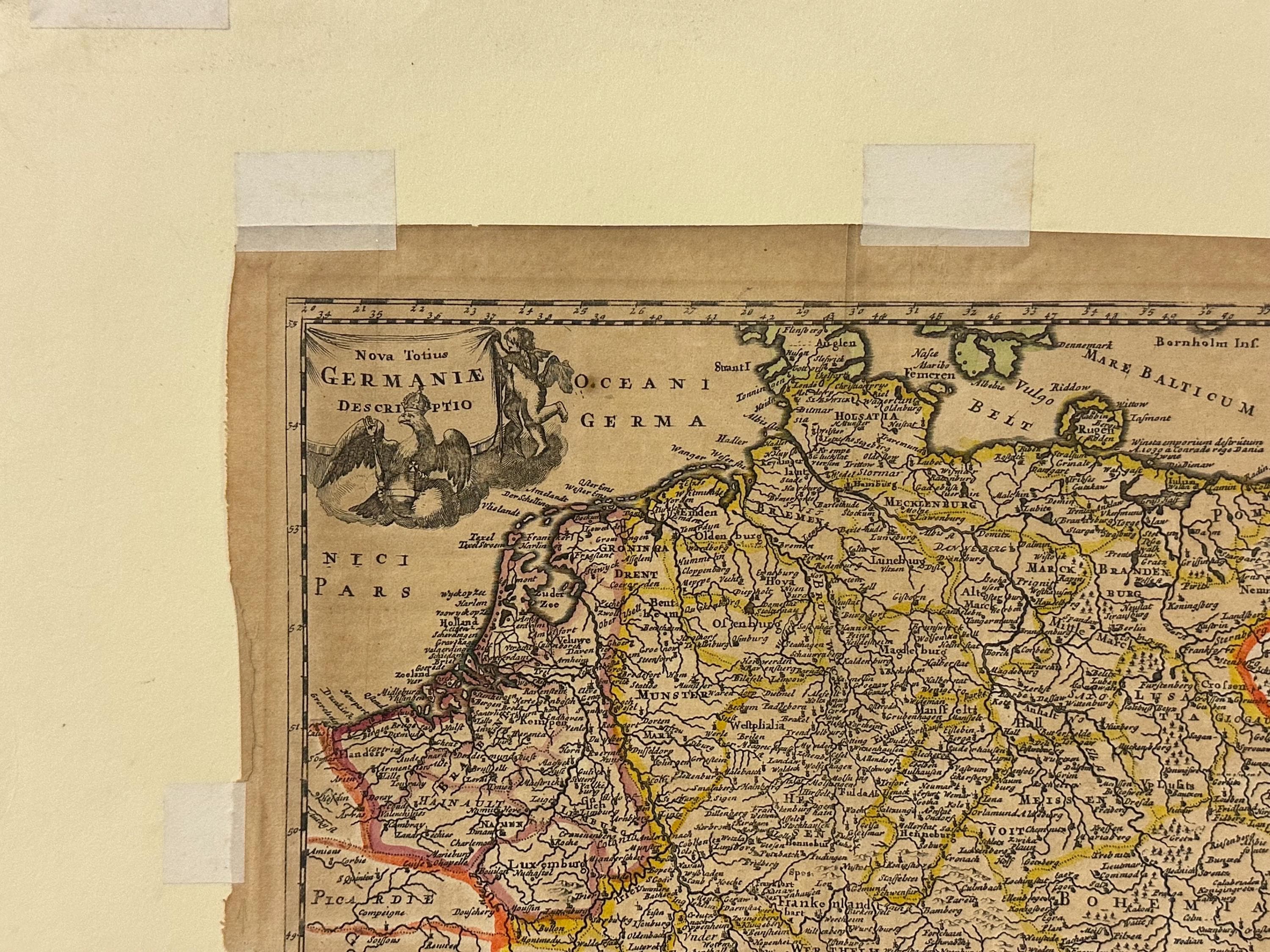
A beautiful and highly detailed 17th- or early 18th-century engraved map titled “Nova Totius Germaniae Descriptio”, depicting the regions of Germany and Central Europe in hand colour.
This historical map shows the numerous states, duchies and principalities of the Holy Roman Empire, with parts of neighbouring France, Poland, Bohemia and the Low Countries. The intricate engraving is enhanced with original hand-applied outline colour in yellow, red and green, highlighting regional borders.
Decorative title cartouche in the upper left corner featuring classical motifs and scrollwork, typical of early mapmaking artistry.
A fine example of early European cartography — ideal for collectors of antique maps or for framing as a decorative historical piece.
It has nibbles around the edge and has been taped to card as was previously framed
Measures approx 34.5 x 30cm
Will be sent via Royal Mail signed for service
Frequently Asked Questions
Does OnlineAntiques Ship Worldwide?
In most cases we do ship overseas from the UK depending on size and weight. However if we haven’t listed a shipping cost to your country please message us as we are always happy to obtain an individual shipping price
How Quick Does OnlineAntiques Dispatch items ?
In most cases we dispatch within 48hrs and we use either a 24hr or 48hr signed for delivery service. If the item is large, such as an item of furniture then it will take 5-7days as we will need to arrange a private courier
Gift wrapping and packaging
We package our items extremely well to ensure fragile items and artwork arrive safely. If you would like your purchase gift wrapped then please add a message or message us directly with details. We are always happy to help as much as possible for that special occasion.
Multiple purchases
If you are purchasing multiple items and we can package together, we can reduce postage/shipping costs. Please message us direct ahead of your purchase so we can make the necessary postal adjustments to your purchases.